My Mom, Milda, had been thinking of taking an Adventure Trip for some time. When she invited Mary and I to join her we jumped at the opportunity. Who wouldn't? 5 nights under the red cliffs and stars outside Moab and 6 days of hiking, biking, rafting and canyoneering the surrounding national parks sounds like a perfect way to spend the week of Memorial Day 2011.
 |
| Lunch on the roof @ Ouray Brewery |
The host city for the trip was
Grand Junction, CO. A sleepy town built on mining roots near the South West corner of the state. We decided to arrive early enough to explore for the day.
 |
| Ouray Waterfall |
After doing a bunch of research on Grand Junction we decided to rent a car and drive to
Ouray, CO for the afternoon and then walk Grand Junction that evening. We definitely made the right choice. Ouray is known as the "Switzerland of America" for it's beautiful situation in the San Juan Mountains. We found a great spot called the Ouray Brewery to have lunch. They have a great roof deck with incredible panoramic views.
 |
| Ouray Panorama |
After lunch we went for a short hike into the hills towards a water fall on the Colorado River. What a beautiful place.
That evening we walked Grand Junction, stopped for a beer at the Blue Moon Cafe and then had dinner at an Indian place before calling it a night so we could be fresh for our early pickup by Austin Lehman at 730am.
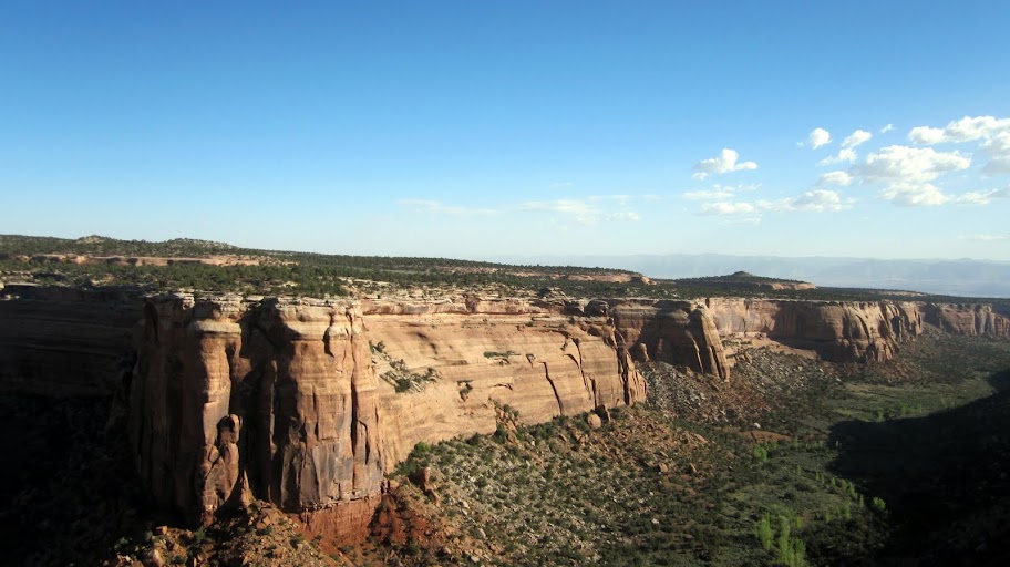
Day 1: Colorado National Monument and Colorado White Water
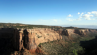 |
| Colorado National Monument |
After a quick breakfast at our hotel. Our guides Matt and Katie were right on time to pick us up. The other guests were ready to go, we did our meet and greet and loaded into the van for our short ride to our first stop, Colorado National Monument. After a windy and spiraling drive to the top of the mesa we stepped out of the van to ponder an exceptional view. Our guides spent some time explaining the week ahead, giving us some local history of the land and prepared us for what to expect. After enjoying the vista we climbed back into the van and drove to our drop point for out first adventure of the trip. Rafting some white water in the Colorado River.
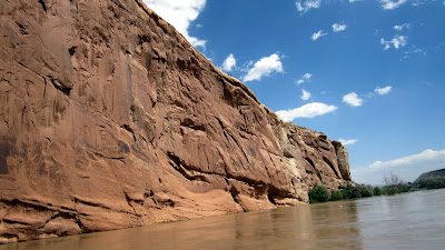
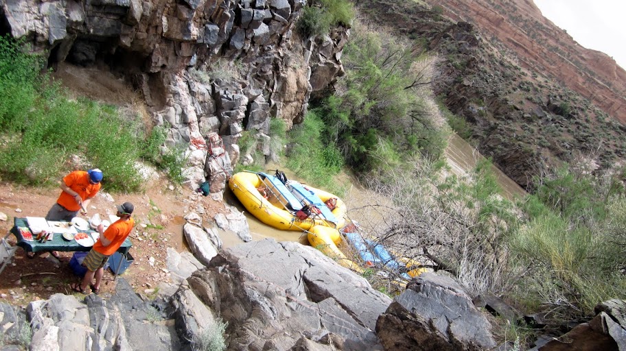
My Mom and I have done a rafting trip in the past. About 15 years ago we rafted the Snake River in Idaho for a week. It was exhilarating and we were looking forward to a similar experience. Since we recently discovered Mary is expecting she decided to sit this activity out. In hind sight she could have done it but, we simply did not know how the river would be and we also knew she would have no escape should there be a problem. She went to the Hotel and read her book for a few hours and waited for us to arrive. The early part of the day was calm and flat. The scenery made up for what the river lacked. I have never seen such majesty in person. Sheer cliffs of red and black. It reminded me of the fjords in Norway but without the lush vegetation.
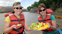
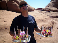
Our guides sliced up a snack for us to enjoy while we took in the natural splendor! A few hours later we stopped for lunch in a small crevice in the cliffs and had turkey and avocado sandwiches. It seemed no matter where we went, the topography whispered of the millenia it took to shape it. You felt as though you should respect the age of your surroundings and keep quiet as we flowed down stream keeping an eye out for the rare mountain lion or billy goat perched on the scrags of the cliffs.
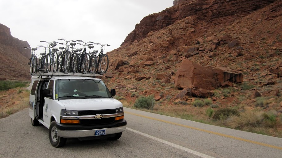
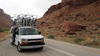 |
| Shag Wagon |
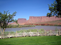
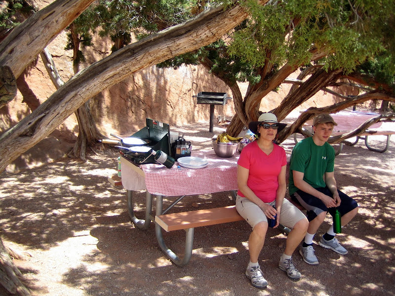
When we reconnected with the "Shag Wagon" we had a signature Austin Lehman WOW snack of water crackers, lox, creme cheese and spring greens before loading back in for our drive to our home for the week,
The Red Cliffs Lodge. Situated on the banks of the Colorado River it was the
perfect base camp for all our activities. That evening we enjoyed a welcome dinner at the lodge, got to know everyone a bit and broke my camera. From this point forward I had to use my Mom's camera on loan. It worked out just fine, but I was a little irritated with myself.
 |
| View from our room at the Lodge. |
Day 2: Canyonland National Park Ride and Hike
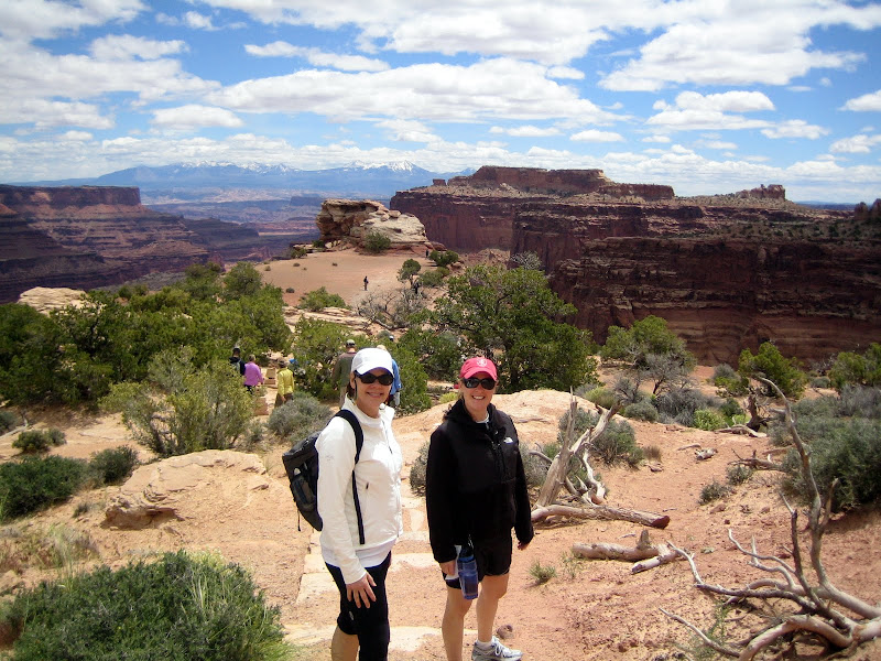
Day two was a perfect blend of hiking and biking through some of the coolest natural formations in the world. Canyonland National Park is a wonder of nature. What used to be an ocean floor hundreds of billions of years ago is now a play land for nature enthusiasts. We began the day with a short ride down from the top of a mesa which led us to our first hike, window Arch; it was a perfect start to the day. Short ride...to a short hike.... A warm up.

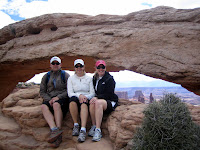 |
| Keith, Milda and Mary at Window Arch |
You will likely get sick of me claiming that each vista, each place to sit and every spot was more incredible than the last. I almost feel as though the trip was designed with this in mind. Every step just seemed to get more incredible. While we were hiking with Katie, Matty our fearless lead guide was making sure everything else was in order.


We were in a place called
Island in the Sky. It is a
mesa that is connected to the main land by only a sliver of land. We started biking at the outermost tip and worked our way out of the park. I used the GPS function on my cell phone over the entire trip and all our
Google Earth KML tracks are available at the end of this post. We started at the top and rolled down through some incredible scenery to our next meeting point. Here we did a second short hike to give Matty and Katie time to load the bikes back onto the shag wagon so we could go to another spot to have lunch.
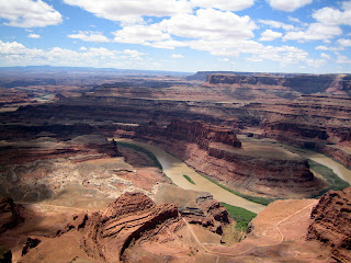 |
| Deadhorse Point |
We had lunch at, Dead Horse Point; a most incredible vista which shows the power of erosion over the millennium. The view made you feel like a bird about to take flight. Soaring high above the world.
Lunch was a wonderfully created bowtie pasta salad with fruit salads and all the fixings. We are wondering if we will loose weight even with all the activity! (I did)
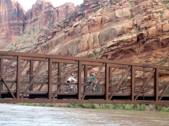
|
Mary and Milda riding across the Colorado River |
 |
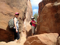
| Pictographs |
After lunch we continued on our ride down towards the entrance to Arches National Park; where we made a pit stop to see a safety video on the Fiery Furnace. A protected place where only 60 permits are sold per day and require you to apply in advance. Of course this was no big deal because Matty K designed our itinerary to make sure we could ride our bikes directly there as one of our stops! I cant even begin to tell you how perfectly planned and executed our itinerary was. There was NO downtime. After watching the video we biked another few miles and stopped where we were able to see ancient pictographs painted on the side of a cliff. Matty just happened to have chocolate covered strawberries in his bag. We had another few miles to go before we crossed the Colorado river to finish the day's riding. That night we had a very nice dinner in town as a group and crashed out early as we knew the next day would be just as action packed!
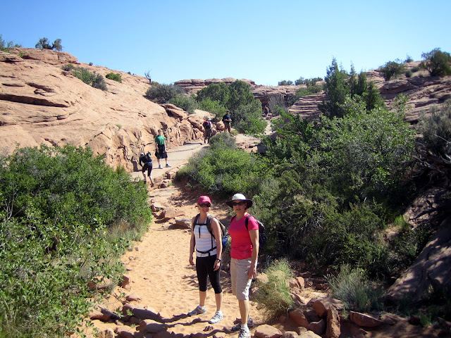
Day 3: Arches National Park
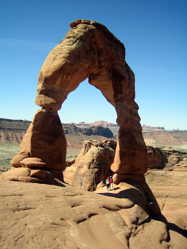
 |
| First view of the Delicate Arch |
 |
| Hiking the slick rock |
 |
| Parfait du Matty |
The next day we wake to beautiful hiking conditions for our Arches experience. Breakfast on the balcony at the Lodge before jumping in the Shag Wagon for our drive to Arches National Park and our first hike. Delicate Arch is on the state licence plate and is one of the most popular places to visit in the State. The hike starts with a few miles over slick rock until you go around the corner and get your first glimpse. While we are all standing in awe of the natural beauty and amazing geological formations around us; Matty was ducking behind a rock and creating another signature Austin Lehman WOW moment. Fresh berry parfaits for everyone! A nice kick before heading back for our next hike!
 |
| Mary, Milda and Keith under the Delicate Arch |
 |
| Mary and Keith at Landscape Arch |
We hike back over the slick rock, across the parking lot and immediately hit another trail. This time.... destination Landscape Arch. This is definitely worth the dusty tourist trail. A beautiful scene for sure; but it helps you appreciate all the special off the beaten path places Matty and Katie take us on the rest of the trip. Many days we saw no other people; only lizards, birds and serene nature.
 |
| Milda and Hunt waiting for lunch |
After hiking back to the Shag Wagon we find Matty hard at work preparing yet another great lunch of tofu tacos, fruit salad and all the trimmings. A perfect concoction of protein and sugars for our next adventure: the Fiery Furnace!
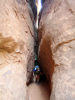
Matty and Katie spent a lot of time discussing the
Fiery Furnace. So the entire group was full of anticipation and excitement. Since we had watched the instructional video the previous day we were ready for this rare adventure. Matty was a trusted guide and he was able to lead our expedition into a very unique place on Earth.
 |
| Mary and Milda entering the Fiery Furnace |
 |
| Barb through a crevice |
The Fiery Furnace is an oddity and is difficult to explain. Hundreds of rock formations, arches and giant boulders protect it and make it a labrynth to explore. One can see how easy it would be to get lost in almost an instant. Every bend and corner has a crevice you have to crawl through to get to the next opening.
 |
| Keith under arch |
If you are claustrophobic do not attempt this hike. The National Park only allows for 60 permits to enter per day and most hikes are led by Park Rangers. So it was truly a unique experience to be able to walk around in such a silent and serene place. We spent about four hours inside twisting and winding our way through the rock formations. Somehow Matty and Katie did not get lost and we all made out way out safely. Looking back, we have all decided it was one of our most memorable hikes on the trip. It was such a unique place we feel so lucky to have been able to experience it. Another WOW moment of fresh sliced pineapple and watermelon hit the spot while under surprise arch. We are all starting to feel spoiled.
 |
| Milda exiting the Fiery Furnace |
That evening we had a lovely dinner on our own. Many people stayed at the Lodge and went to bed early after a long day. Matty was willing to take me into town where we went to the Moab Brewery where he watched me try a number of local brews while we discussed politics, economics and life as we ate. My Mom and Mary had dinner at the lodge and called it a very early night.
I slept like a baby that night as did everyone else I am sure!
 |
| Surprise Arch - Fiery Furnace |
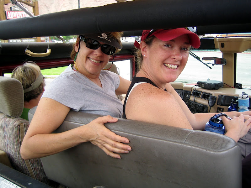
Day 4:
Moab 4x4 Adventure and
Fischer Towers Hike
 |
| Milda and Mary in the Hmmer |
 |
| Devil's Backbone |
Anyone that knows me will attest to the fact that I am not a good passenger. The 4x4 tour definitely made me feel....shall we say.... uncomfortable. We were in a giant Hummer, driving up slick rock, with 500 feet of canyon on either side. I just wanted the guy driving to shut up and focus on driving!
Everyone else sure seemed to enjoy it a lot. Our eventual destination was well worth the terror. A perfect vista over the Colorado River. After the 4x4 Adventure we went to the brewery Matty and I had dinner at the previous night and had a nice filling meal to round up our first half of the day.
 |
| Fischer Towers |
Many in the group seemed to need a bit of a break, so the afternoon activity was a little less attended. Mary was tired so she went back to the room for a nap while my Mom, Ron, Barb, Elena, Hunt and I continued on the day with Matty and Katie to Fischer Towers.
 |
| Milda on the ladder |
The trail head is only a 20 minute drive from the lodge. We were still trying to get over the food coma from lunch, but once we started hiking there was no time to relax. The hike was fairly technical and required the use of a fixed ladder over a small ravine to get to the base of the towers. These towers were created by wind erosion versus most of the area which was created by water. Another WOW moment from Matty was home made ice cream out of a ice cream ball. It was perfect!
 |
| Keith on the Fischer Tower Hike |
The end of another perfect day was upon us. We spent the evening together at a great steakhouse in Moab before retiring with visions of tomorrow's canyon-eering adventure.
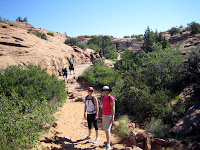
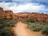
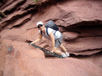
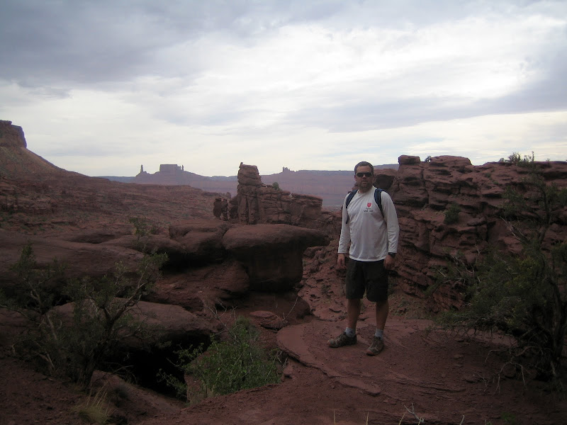
Day 5: Professor Canyon Hike
 |
| Mary, Milda and Matty at the start of the hike. |
We awoke to yet another beautiful desert day. Perfect for hiking. Our activity was a hike from the mouth of a stream to it's source deep up the canyon. Our feet were to get wet, but it was all in good fun. At first you try to keep them dry.... but once you make the first mis-step...it is all over and you are wading up to your knees.
 |
| Milda and Keith |
This was another Matty and Katie special. A hike no other tourist would do. They wouldn't even know it exists. We saw no one else. Just natural beauty, frogs, lizards and the sounds of the stream. It was a decent hike of about 10 miles total. 5 miles in and 5 miles out, but it was a nice gradual incline gaining 1000 feet of elevation over those 5 miles.
By the time we reached the source of the stream the canyon walls were quite high. It was truly incredible to start in reasonably flat land and end up in a true canyon, all carved by the water over millions of years. There was beautiful flora everywhere and it was hard to resist stopping every few yards to take another picture.

The end of the hike was well worth it. We discovered (as Matty and Katie already knew) that the stream was fed by a small waterfall out of the rock. Absolute beauty. We all walked under the waterfall and enjoyed the refreshing shower nature provided us on a hot day.
As always the hike in looks different than the hike out. A slight change in the shadows of the sun and the reverse perspective of everything makes it all seem brand new. This was another highlight of a trip full of highlights.
 |
| Mary on the hike out. |


 My Mom and I have done a rafting trip in the past. About 15 years ago we rafted the Snake River in Idaho for a week. It was exhilarating and we were looking forward to a similar experience. Since we recently discovered Mary is expecting she decided to sit this activity out. In hind sight she could have done it but, we simply did not know how the river would be and we also knew she would have no escape should there be a problem. She went to the Hotel and read her book for a few hours and waited for us to arrive. The early part of the day was calm and flat. The scenery made up for what the river lacked. I have never seen such majesty in person. Sheer cliffs of red and black. It reminded me of the fjords in Norway but without the lush vegetation.


 We were in a place called Island in the Sky. It is a mesa that is connected to the main land by only a sliver of land. We started biking at the outermost tip and worked our way out of the park. I used the GPS function on my cell phone over the entire trip and all our Google Earth KML tracks are available at the end of this post. We started at the top and rolled down through some incredible scenery to our next meeting point. Here we did a second short hike to give Matty and Katie time to load the bikes back onto the shag wagon so we could go to another spot to have lunch.


 The end of the hike was well worth it. We discovered (as Matty and Katie already knew) that the stream was fed by a small waterfall out of the rock. Absolute beauty. We all walked under the waterfall and enjoyed the refreshing shower nature provided us on a hot day.


 r
r


